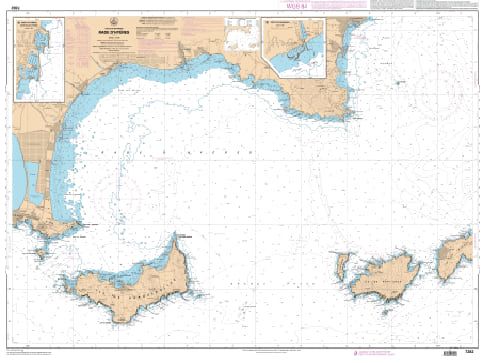
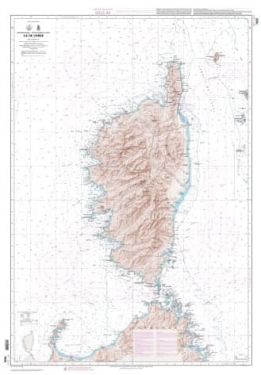
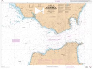
SHOM charts Mediterranean South France - North-East Spain

TheSHOM Mediterranean South France - North-East Spain charts cover the Mediterranean area between the South coast of France and the North-East coast of Spain. It includes all the coasts and the classic details of a SHOM chart.
Need an advice ?
SHOM MEDITERRANEAN CHARTS SOUTH FRANCE - NORTHEAST SPAIN: SHOM MEDITERRANEAN CHART
TheSHOM Mediterranean South France - North-East Spain charts cover the Mediterranean area between the South coast of France and the North-East coast of Spain. It includes all the coasts and the classic details of a SHOM chart.
THE SHOM CHART
These SHOM charts are made of paper and filled with latex in order to be usable in humid areas and to resist water. They keep an easy writing. They are folded and updated charts.
Details of areas covered and scales at the bottom of the page.
Read more
Technical specifications
- Dimensions :
- Folded: A4 (21 x 29.7 cm)
- Unfolded : A0 (84,1 x 118,9 cm)
- Available areas:
- 6610 L : from Bandol to Cap Sicié, Rade du Bruc - Scale : 1 : 20000
- 6612 L - From Cassis to Bandol - La Ciotat Bay - Scale : 1 : 20001
- 6616 L - From Cap Bénat to Cap Lardier - Rade de Bormes - Bay of Cavalaire - Scale : 1 : 24999
- 6684 L - Gulf and Port of Fos - Scale: 1 : 25005
- 6693 L - From Saintes-Maries-de-la-Mer to Port-Saint-Louis-du-Rhône - Scale : 1 : 49946
- 6767 L - From Fos-sur-Mer to Marseille - Scale : 1 : 50000
- 6838 L - Saint-Raphaël surroundings - From the Pointe des Issambres to the Pointe d'Anthéor - Scale : 1 : 20006
- 6839 L - Etang de Thau - Scale: 1 : 30000
- 6843 L - from Cabo Creus to Port-Barcarès - Scale : 1 : 50500
- 6844 L - from Port-Barcarès to the mouth of the Aude river - Scale : 1 : 30000 Leucate - Bages - Gruissan - Scale : 1 : 50000
- 6907 L - Etang de Berre - Scale : 1 : 24955
- 6951 L - from Fos-sur-Mer to Capo Mele - Scale : 1 : 249330
- 7003 L - Cap d'Agde - Mouth of the Hérault river - Scale : 1 : 24955 Scale : 1 : 15000
- 7004 L - Gulf of Aigues-Mortes, Ports of Palavas-les-Flots, Carnon-Plage and Saintes-Maries-de-la-Mer - Scale : 1 : 14998
- 7008 L - from Cabo de San Sebastian to Fos-sur-Mer - Scale : 1 : 250000
- 7053 L - from Sète to the Pointe de l'Espiguette - Scale : 1 : 49865
- 7054 L - from the mouth of the Aude to Sète - Scale : 1 : 49959
- 7091 L - Surroundings of Toulon - Scale : 1 : 25009
- 7093 L - Toulon Harbour - Scale: 1 : 10001
- 7200 L - from Cap d'Antibes to Cap Ferrat - Scale: 1 : 24794
- 7203 L - from the Balearic Islands (Islas Baleares) to Marseille - Scale: 1 : 500000
- 7204 L - from Marseille to Elba Island (Isola d'Elba) and the Bouches de Bonifacio - Scale: 1 : 501686
- 7205 L - Gulf of La Napoule - Gulf Juan - Lerins Islands - Cannes area - Scale : 1 : 15003
- 7229 L - from Nice to Piombino - Scale : 1 : 250000
- 7267 L - Surroundings of Saint-Tropez - Scale: 1 : 20000
- 7282 L - Rade d'Hyères - Scale: 1 : 24999
- 7390 L - Port of Marseille - Scale: 1 : 10000
- 7391 L - Southern outskirts of Marseille - From Frioul Islands to Jarre Island - Scale: 1 : 12500
- 7392 L - from Cap Couronne to Cap Croisette - Gulf of Marseille - Scale: 1 : 24999
- 7393 L - from the port of La Pointe Rouge to Cassis - Calanques of Cassis - Scale : 1 : 19999
- 7406 L - from Marseille to Toulon - Scale: 1 : 50095
- 7407 L - from Toulon to Cavalaire-sur-Mer Porquerolles, Port Cros, Levant - Scale : 1 : 50171
- 7408 L - from Cavalaire-sur-Mer to Rade d'Agay - Scale : 1 : 50000
- 7409 L - from Rade d'Agay to Monaco - Scale : 1 : 49745
- 7434 L - Ports of Sète, Port-la-Nouvelle, Port-Vendres and Collioure - Scale: 1 : 15000
- 7441 L - Approaches and Ports of Monaco - from Cap d'Ail to Cap Martin - Scale : 1 : 7500
- 7442 L - from Villefranche-sur-Mer to Menton - Scale : 1 : 20000
- 7443 L - From Cap Ferrat to Capo San Lorenzo - Scale : 1 : 49600
- 7507 L - From Golfe du Lion to Bouches de Bonifacio - Scale : 1 : 505705
- 7663 L - from Cap de Barcelona to Cap Cerbere - Scale : 1 : 175000
- 7664 L - from Cabo Tortosa to Cabo de Tossa - Scale: 1 : 175000
- 7665 L - From Cap Negre to Cap Cerbere - Scale : 1 : 50000


